A smart street mapping initiative, using technology developed by Oxford Robotics Institute, could help transform how infrastructure services are managed in the city.
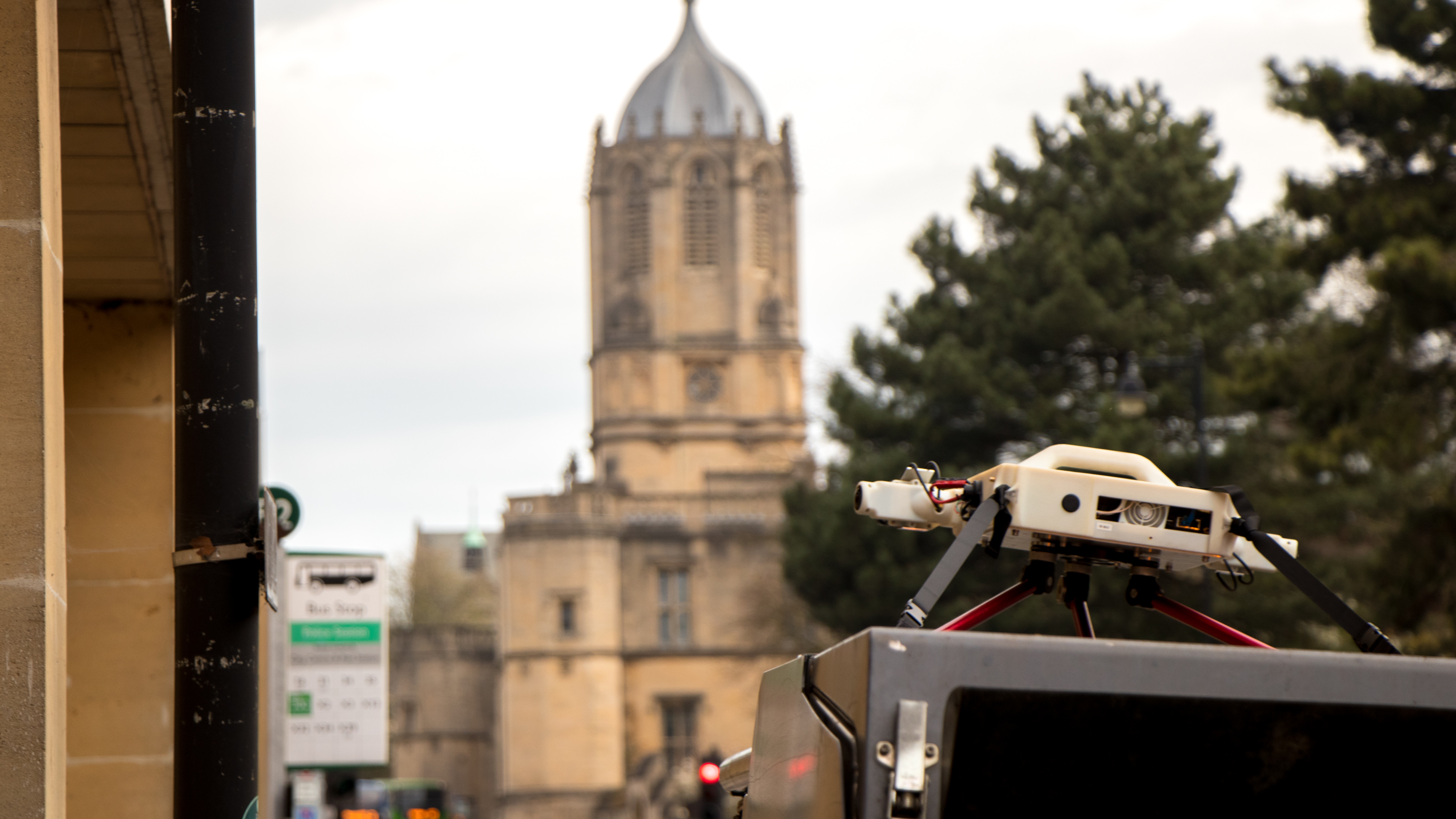
In collaboration with the City Council the University of Oxford’s Robotics Institute (ORI) are fitting their NABU mapping technology, originally developed for autonomous vehicles, on street cleaners over the coming months.
NABU is a self-contained survey tool that uses various sensors to create fast, detailed and accurate maps of the environment. By attaching NABU to the council’s street cleaners, ORI researchers will collect data of the city and create 3D maps of Oxford.
The trials are part of the city’s Smart Oxford initiative, which promotes the adoption of information and communications technology to improve the efficiency of services. Smart street mapping will monitor what is happening in the city and how the city is evolving over time. This will help Oxford City Council provide better services and improve the quality of life for residents and visitors.
This trial will help us with our own research for autonomous vehicles and will help the Council and other partners gather data that can improve the management and maintenance of the city.
Paul Newman, Professor of Information Engineering at the University of Oxford
At the same time, the information collected will be used to support autonomous vehicle research at the ORI.
The data being trialled, as part of the project will include:
- road and pavement surface damage
- air quality
- people numbers and movement
- litter and fly-tipping
- parked vehicles
- broken streetlights and signs
- heat loss from buildings
The information gathered will enable the City Council and its partners to better plan and implement their approach to community management. It will also inform a library of unreported issues such as fly-tipping, which the service will then be better placed to act upon. If initial trials are successful, the new innovation could see the City Council add the mapping tool to its fleet of vehicles.
View the sensor generated footage of a 3D map of Oxford's Cornmarket Street here:
Smart street mapping marks the first time that ORI innovations have informed local developments, and is testament to the role that University research plays in supporting better city life.
Paul Newman, Professor of Information Engineering at the University of Oxford, said: ‘We are really excited to be working in our home city with the City Council to map and gather data using one of our NABU sensors on a street sweeper. This trial will help us with our own research for autonomous vehicles and will help the Council and other partners gather data that can improve the management and maintenance of the city’.
Sebastian Johnson, Vice Chair of the Smart Oxford Board and Project Manager at Oxford City Council, said: ‘Working with the Oxford Robotics Institute we are exploring how the City Council’s fleet of street cleaners and refuse collection vehicles can be fitted with sensors, developed by the ORI, to map the city.
‘At the same time we are looking to gather information and data that can help us improve the way we run the city as an efficient and effective Council. Our open data platform will also allow innovators to explore and use the data to create new ideas and applications.
‘Oxford is the home to world-leading mobile autonomy and robotics research and development, and the City Council and our wider partners on the Smart Oxford Board are keen to support innovation and research to benefit those living in the city.’
Information updates will be published regularly so that local people will be able to track the initiative’s progress on the Smart Oxford website, via its publicly accessible, Oxfordshire Open Data page.